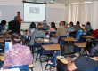
The Center for Hemispherical Cooperation in Research and Education in Engineering and Applied Science (CoHemis) celebrated its fourth consecutive summer camp during July 13-19 of 2009. This year main topic was “Teaching Actively and Learning as a Team” and incorporated for the first time a workshop of remote sensing and geographic information systems (GIS). This component of the camp was organized by the GERS Lab. Fernando Gilbes, Vilmaliz Rodriguez, and Ramón López prepared an innovative game that included basic principles of image processing, GIS, and navigational skills using GPS. The participants used ENVI and ArcGIS in order to follow a series of clues until complete the game. Two groups were walking around the campus with a Garmin handheld GPS and other two were in the computer laboratory working with an aerial photo of the same geographic area. This game was based on the well-know game Geocaching and it was called Gerscaching. All participants enjoyed very much the activities and at the same time learned about these high-tech tools. Based on this positive experience it is expected to repeat this workshop in future activities.