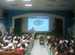
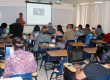
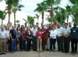
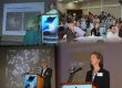
Geographic Mapping Technologies Corp. (GMT) and the Center for Hemispherical Cooperation (CoHemis) organized a technological seminar about Geographic Information Systems (GIS) for governmental and academic applications. This activity took place during March 19 of 2009 in the Abbott Room of the Chemistry Building at UPRM and it was divided in two parts. The morning section was focused on how to integrate ArcGIS tools in teaching and research activities of UPRM. It was also presented to the audience the concept of “ArcGIS Campus Pack”, an innovative program that will allow having a full campus license in a relative low cost. Most of the participants liked the idea and CoHemis committed to follow up on finding the way to implement this program at UPRM. As part of this section Fernando Gilbes Santaella was invited to talk about the “Geographic Information Systems (GIS) at GERS Lab”. He showed the applications of the GIS tools in oceanographic and coastal studies and explained the implementation of GERSVIEW. The afternoon section mainly covered topics on how to use these tools for government administration, including municipalities’ requirements and planning.