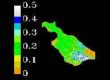
This past summer of 2008 Natlee Hernández worked as Remote Sensing Technician during an internship for the Eastern Geographic Science Center Division in Reston, Virginia, at the National Center of the U.S. Geological Survey. Her supervisor was Dr. John Jones, a Researcher Geographer. She worked in the project called “Calibration of 2005 Imagery in South Florida Everglades” as part of the main project titled “South Florida Landscape Dynamics”. The principal objective of this project is to develop and apply innovative remote sensing and geographic information system techniques to map the distribution of vegetation and related hydrologic variables such as evaporation through space and time. Natlee worked with images from two sensors, MODIS and TM, collected on the Everglades during 2005. As part of her tasks was to create NDVI products, use METRIC and Simplified codes to get evapotranspiration outputs for TM atmospherically corrected and compare them with the uncorrected imagery. MODIS imagery was downloaded, the coordinates were changed to UTM and a same geographic subset for TM imagery was created. Her results showed that the Empirical Line atmospheric correction method was effective for the TM imagery. “This internship was a great experience because I learned other ways to use the Remote Sensing Technique” she described it.