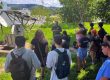
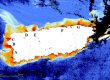
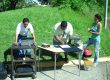
Nine students from various departments took the advance remote sensing course (Geol 6225) in Spring 2023. As part of this academic experience, they had to design, propose, and develop a research project that must include image processing with the software ENVI. At the end of the semester all the projects were orally presented, and written reports were submitted which are published on this webpage. The diverse fields of the students are shown in the final products. The projects included monitoring a volcano in Guatemala, evaluate the impact of Hurricanes Maria and Fiona, coastal geomorphology changes, exploration of metal deposits, study of the soil temperature models, and land cover changes. All projects were exceptional and provided the students with the experience of applying the knowledge acquired during the course. It also allows them to recognize the advantages and limitations of these tools.
The written reports are available here in the following link.