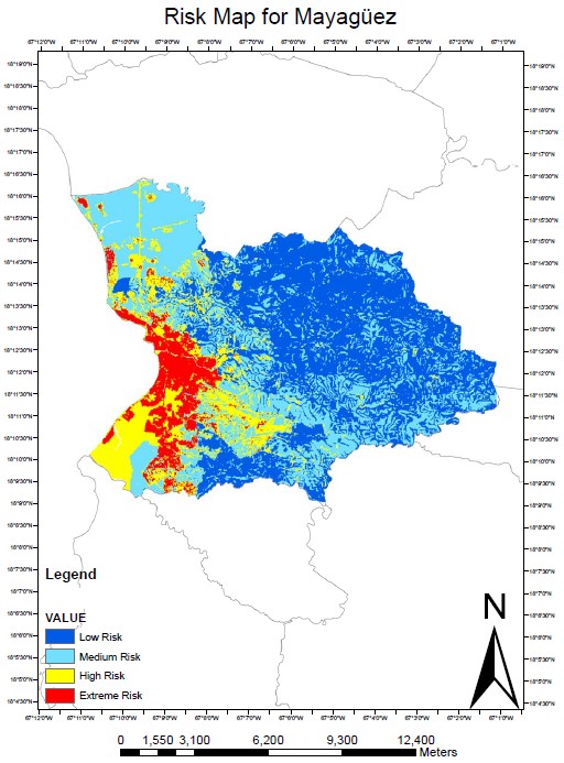
Ivelisse Lopez and Natlee Hernandez successfully defended their undergraduate research during May 8, 2008. Ivelisse in her second research project used a Geographic Information System (GIS) to assess the risk of a earthquake in Mayaguez city. She used two equations based on different rationale and created two risk maps that were analyzed. The resulting maps identified areas of Mayagüez at different risk zones and clearly show that the coastal area is at more risk than the mountainous area. The whole city of Mayagüez and particularly the urban areas should be studied in more detail using additional GIS coverage layers for the city such as liquefaction hazard maps or tsunami hazard maps. On the other hand, Natlee in her also second research project analyzed the grain size, composition and spectral response of deposited sediments in Mayagüez Bay. The grain size distribution demonstrated that the offshore stations have grains with lower diameter than the inshore stations. The composition of the grains shows more carbonates on Añasco River and more terrigenous in Yagüez River. Along the three rivers was showed the lack of organic matter. These results helped to better understand the dynamics of suspended sediments in Mayagüez Bay and provided recommendations for future application of remote sensing in this region.


