A multi-site comparison on mesophotic reefs from Mona Island, PR to St. Croix, USVI
Sponsor: Caribbean Coral Reef Institute, University of Puerto Rico – Mayagüez
Collaboration: Cooperative Institute for Ocean Exploration, Research and Technology and the University of North Carolina – Wilmington
Funding: NOAA Center for Sponsored Coastal Ocean Research
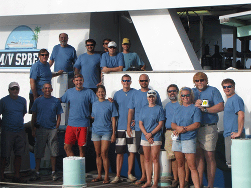
Vessel: M/V Spree, a 100-ft commercial dive vessel
The Players
- Richard Appeldoorn – UPRM – ROV operations and project PI, shallow diver
- Ivonne Bejarano – UPRM – Deep diver
- Milton Carlo – UPRM – Deep diver
- Mathew Craig – UPRM – Shallow CCR diver, fish, ROV team
- Michael Winfield – UNCW – Shallow CCR diver and assistant dive officer
- Doug Kesling – UNCW – Deep diver and Chief Dive Officer
- Matt Lucas (Week 2-3) – UPRM – Shallow Diver, coral processing
- Dani Mateos – UPRM – Shallow Diver, fish collection, ROV team
- Michael Nemeth – UPRM – Deep diver
- Francisco Pagan – UPRM – ROV operations and tech
- Nick Schizas – UPRM – Invertebrate processing and genetics
- Clark Sherman – UPRM – Deep diver and Geomorphology
- Derek Soto – UPRM – Shallow diver and coral processing
- Ernesto Weil (Week 1) – UPRM – Shallow diver and coral processing
Objectives
Our mission over the next three weeks is to explore mesophotic coral ecosystems in the US Caribbean. We are interested to see how these develop relative to variations in degree of inclination and other aspects of the geomorphology of the insular slope, the amount of sediment that may be moving down the slope, and the historical exposure to waves and currents during the last sea level rise. The trip will take us to sites along the main Puerto Rico – Virgin Islands Platform, isolated islands and submerged seamounts. We will also be collecting corals and bottom samples. To maximize the use of the coral samples collected, they will be employed in a variety of studies. An analysis of the coral’s DNA will help determine the degree of gene flow among areas across the region. There will also be a genetic analysis of their symbiotic zooxanthellae (the algae that live inside coral tissues and use light to provide much of the food the corals use) to help understand how the corals may adapt to low light conditions by utilizing different strains of zooxanthellae. The reproductive biology of corals will be studied through histological analysis of their tissues, while morphological studies will further aid in their identification, as corals often change their shape, again as an adaptation to living in low light conditions. Bottom samples are examined to characterize the small crustaceans and other organisms the live among and within corals.
Photo Credits: Underwater photos – D. Kesling. ROV and shipboard photos – R. Appeldoorn
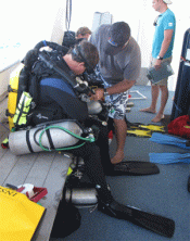
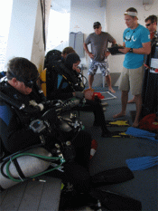
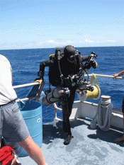
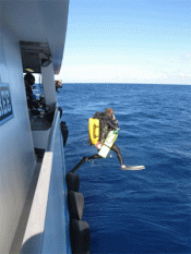
The Routine of Rebreather Diving
15 April 2011
Location: The dock at Magueyes Island
We are off, finally, sort of…
9:00 am. The M/V Spree, our home for the next three weeks arrives at the dock on Magueyes Island, home of the University of Puerto Rico – Mayaguez’s Department of Marine Sciences. But we are not all here. One had to cancelled at the last minute, while Ernesto was borderline until yesterday. Then, Doug and Mike got delayed coming out of North Carolina and were not scheduled to arrive until just before departure.
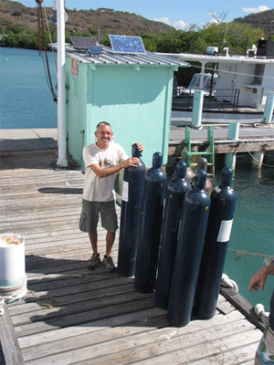
We start loading all the scientific and diving equipment needed for our cruise: rebreathers, cylinders premixed with a combination of air, oxygen and helium (trimix), dive gear, materials for processing and storing samples, the remotely operated vehicle (ROV) and its associated cable, tracker and control box, a mini hyperbaric chamber (just in case!) and lots of cameras and computers. By noon most of the heavy gear is on board and people are off doing last minute errands.
After a meal on shore everyone starts to board and final preparations are made. Gear is properly stored for our crossing of the Mona Passage. The ROV tracker is installed on a custom-made pole that can be lowered over the side during ROV operations. The rebreathers are set up, and scuba gear is set up on the tanks, all in preparation for the next morning.
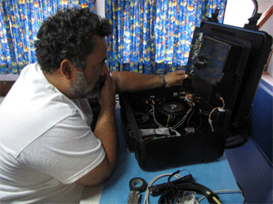
At this point we are on our way to Mona Island. The weather is good and we are hoping to sample at a site where wind and waves prevented us from sampling on last year’s cruise. The rebreather divers are making a few last checks, especially our late arrivals. That is when we discovered our first casualty! The head on Milton’s rebreather, the computer brains and functional control of unit, fails to turn on. If the unit is lost, we are down a deep diver. A few frantic, and late night, phone calls are made. There is a chance that one of our shallow units can be sacrificed for deep diving, if the head on that one is set up for use of trimix. Tomorrow will tell; it is past midnight and we all go head to our bunks.
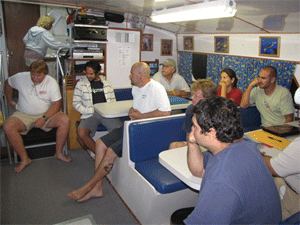
9:45 pm. Our delayed divers show up, and a good thing too, as they are in charge of diver safety. We all pile into the Spree’s cramped lounge/workspace/dining area for a briefing by the captain on boat and diving operations. The rules for toilet operations alone take 15 minutes, but if you want a smooth operation… After that our chief scientist, lead scientific diver and dive safety officer go over the expected operations for tomorrow’s dives and the days to follow: dive sites, dive teams, functions, report writing and storage of all video and still camera imagery.
16 April 2011
Location: Northwest Mona Island
Innovate, Improvise, Overcome – Then go figure!
We start off the day confronting our rebreather problem. Matt’s rebreather head can run trimix, so off it goes to Milton. The divers go in at 9:00 am without a hitch. They hit the bottom at 120 ft and face a long swim down slope to 230 ft. The slope consists of series of steep and shallow inclinations, with the steeper areas having more relief and sponge cover on a bottom covered mostly with rubble and rhodoliths (algal-formed calcareous rocks). The less steep areas have a sand covering with occasional large barrel sponges and patches of rubble.
The divers reach their target, the top of a steeper zone with a good live bottom, and set to work. Lines are laid out for phototransects of the bottom and for visual census of fishes. Coral collections begin. It is clear from the outset that the coral community, though not abundant, was diverse, with a number of species found that normally occur mostly at shallower depths. This is reflected in Michael’s samples, where 8 species (*) were collected. Ivonne notes some large residents: yellowfin groupers, dog and mutton snappers, a small reef shark and an abundance of invasive lionfish. Upon finishing the phototransects Milton starts samping lionfish, which are known to be voracious predators and threaten to alter native fish communities; Matt will be examining what they eat at these depths. Milton spears several, the largest being 15 in. Their stay at the site is brief, and after 20 minutes they are moving back up the slope, stuffing samples into sample bags as they go. At the first safety stop, the sample bags are sent up on a lift bag to be recovered by the Spree and the team of scientists waiting to sort, categorize and preserve the specimens. The divers still have another hour to do their decompression. Milton spears another lionfish – a monster of 17 inches… or so he says. Unfortunately, the fish came off the spear before he could get to the surface… or so he says.
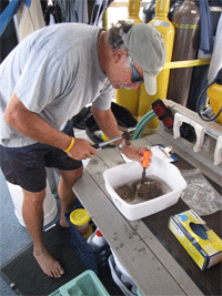
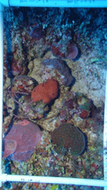
Meanwhile, action shifts to the ship where the lift bag with the samples breaks the surface and plastic bags start spreading out, being dispersed by wind and current. Thinking these are our precious specimens, Matt jumps in to recover them all, only to find they are empty, just unused bags that broke out of a side pocket – the samples are safe. After lunch, the ROV team gets its turn. The wind and current are now up, so maneuvering is going to be a challenge. In addition, we are trying out the tracker for the first time as aid to the ship’s navigation. I will not go through the litany of problems that followed, but despite all those we did get some imagery down to 230 ft before the survey had to be aborted.
We now head for more sheltered waters, where the shallow divers will go in. Doug has a plan to put the cannibalized rebreather back in action. By taking out the batteries, the computer erases the data from the previous dive, and allows another to be made without the computer thinking safe diving limits are being exceeded. Matt and Milton can then share the breather head. This is potentially dangerous, but since each diver is making only one dive a day, and they each have backup computers to keep track of repetitive dives, the risk is considered minimal. So Matt and Mike will use shallow rebreathers to collect more lionfish to give a shallow water comparison on their diet, Ernesto and Derek are off to collect more corals, and Rich and Francisco are following Dani to search for the elusive black grouper. The latter was not found, but excitement came from seeing several large dog snappers engaged in complex behavior, perhaps related to courtship. And excitement for everyone else came in the form of looking for the three divers, who came up a long way from their expected location, since the current on the bottom was running opposite of what was expected.
At the end of the day, Milton takes the batteries out his malfunctioning rebreather head and puts them back in, a procedure he tried several times previously. This time it fired up and seemed to run perfectly. Go figure!
*Agaricia lamarki, Undaria humilis, Leptoserus cailleti, Helioserus cuculata, A. undata, Madracis pharensis luciphogus, Stephenocian intercepta, Montastraea cavernosa.
17 April 2011
Location: Northwest Mona Island
We are good to go. (Ha!)
We are back on our site from yesterday, hoping to sample now at 165 ft and to try the ROV survey again. With our rebreather problems seemingly settled, the rebreather divers jump in at 8:50 am and head for the bottom. But 4 minutes later Michael and Milton are back on the surface. We were all very impressed to know that in that time Michael was able to dive to 477 ft and back! But, it was only ANOTHER rebreather head failure, and this time there will be no trickery; we are now down a diver.
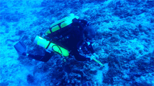
Meanwhile the remaining three divers get to the bottom to conduct the phototransects and fish surveys. The site is located near the base of a zone of steeper inclination, with a structure that appeared similar to that at the deeper site: rubble, sponges and algae. However, the biotic communities are not the same. While the deeper site was species rich, this site had few corals and few large fish. Nevertheless, they are able to grab a few much appreciated corals for Nick and Ernesto waiting above. And on the way up they are rewarded with seeing a 3-ft cubera snapper.
There is still time before lunch and the conditions are “good” so we make a snap decision to send down the ROV, but not before having a meeting to make sure the drivers, captain and cable team are all on the same page. Immediately upon hitting the water it is clear the surface current is stronger than we thought. Yet, the ROV gets down to 245 ft before control is lost and the ship starts dragging it up and backwards. The captain has a plan… but first the crew wants lunch.
We attempt to control cable drag by the current by weighting the line down to 100 ft, but winds and currents have increased. The cable goes down, but the current still takes it, eventually under the ship and wrapping it around the pole holding the tracker sonar. The next 15 minutes are spent frantically trying to unwrap the cable and free the ROV. Meanwhile, inside Francisco is driving the ROV totally unaware of the activity going on outside. He is busy getting video footage of the upper slope down to 165 ft, but only in a limited area. Eventually, however, the current catches up with us and the dive once again is terminated early. And what did we see? “Nothing exciting.”
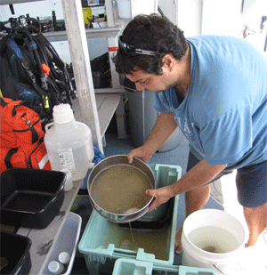
We finish the day by moving over to the southeast side of Mona to collect shallow corals and check out a yellowfin and tiger grouper aggregation site. On the way over we stop by the boat (a Cabo 42?) of a prominent doctor to inform him he and his party were “sport” fishing in a no-fishing zone. They politely move, but since we had also seen them fishing off in the distance the day before we have little hope our warnings will have effect. After the shallow dives, the coral team comes back with samples… and lionfish. The grouper hunters strike out; although the actual predicted spawning time is not for another week, the complete absence of groupers indicates that the spawning season ended the month before.
18 April 2011
Location: Desecheo Island
Just a bit of current
After an overnight transit we awake to find ourselves on the south (sheltered) side of Desecheo, a small island off northwest Puerto Rico and home to goats and monkeys. We have no high resolution bathymetry to guide our search, but Milton was generally familiar with the area and suggested we look at a drop off on the west side. With the ship’s fathometer we make a couple of passes and the area looks good, that is there is some bottom relief that may indicate outcrops that may support corals. The divers go in at 9:00 am, and like clockwork the sample bag comes up a half hour later.Looks like they hit the motherlode; lots of coral samples and other invertebrates, and Nick, Ernesto and Derek jump to work.
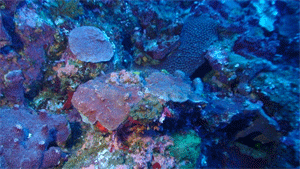
Then we wait. One hour. Two hours. Two and half hours and still no divers. Finally they reach the surface (and just 15 minutes until lunch!). Safely back on board, they are pressed for details. The site, at 230 ft, was indeed excellent. Although the base was a low sloping rubble bottom covered with Lobophora, a brown alga, there were plenty of rock outcrops that provided space for a well-developed mesophotic community, with lots of corals, sponges and other organisms – one of the most diverse sites we have seen. Most interesting and impressive was the abundance and size of Montastraea cavernosa colonies, a shallow species that was one of the most abundant corals at this location. At other sites both the number and size decline markedly with depth, being infrequently seen below 200ft; but the water here is very clear, so more light would penetrate to depth. While few big fish were seen (one beautiful yellowfin grouper), the small reef fishes were abundant. Their delay in coming up, however, was not due to their desire to remain in such an area, but to having to fight the current as they came up slope. After much delay and exertion, they eventually gave up on their plan to come up along the slope and just came up off the bottom, to be whisked away by the current. The time spent in their unsuccessful attempt added greatly to their decompression time.
During lunch, Capt. Frank does a series of depth-profile transects so we can later develop a surface contour map of the site. At this site, we are occasionally within cell phone range of Puerto Rico, and when connected the crew frantically checks email. Included in this are some key requests to Silent Diving, maker of the rebreathers, to see if we can get a couple of new heads sent over in time for our port call on Friday.
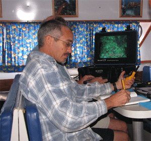
After lunch it is time for Team ROV. We modify yesterday’s plan by putting more weight on the cable; we are also shooting for a “slack” tide. To our amazement, the system worked pretty well. We only had a limited amount of cable to work with, so we could barely get down much below 230 ft, and most of our time was spent at 175 to 155 ft. Here the bottom was more gently sloping and covered with Lobophora. But within this were many rock outcrops, and these were covered with a diversity of corals, sponges, black corals and other hydrozoans.
The day’s field activities ended with a dive on a promontory off the north side of Desecheo. Beautiful scenery and a diverse community coupled with wicked current. And then there was report writing and logging of video and still imagery.
19 April 2011
Location: Desecheo Island
The vertical thruster is kaput!
Our rebreather divers get off to an early start and are greeted by a welcomed reduction in current. The dive was similar to that of the previous day and what was seen with the ROV. At 165 ft the slope is more gradual and outcrops somewhat smaller, but they support a diverse benthic community. Large feeding scars were found on several large barrel sponges, the result of hungry hawksbill turtles; one large turtle was observed by the divers during their ascent. Others were observed from the boat. More coral and bottom samples come up that are processed for future analyses. This time the divers come up on schedule and the decision is made to put in the ROV before wind and current pick up. Capt. Frank has found a mound off the north side of Desecheo with interesting bottom relief.
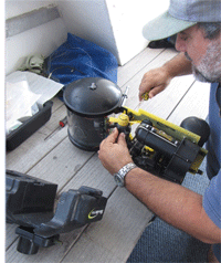
The ROV goes down without a hitch. While the weighted tether system limits our depth, it has solved the problem of surface currents taking the cable. Unfortunately, it doesn’t do much for deep currents. Initial observations from 230 up to 210 ft went well, very similar to the other sites at Desecheo, but attempts to go up slope met with little success. The strong current the divers met the day before was back, and after an hour the dive is terminated – except the ROV would not ascend on its own; we had to haul it up by the cable. When we got it back on board, the problem was easy to see. The blades on the vertical thruster had been sheared off. Francisco spent the afternoon stripping the ROV down to access the thruster. After inspection and discussion, we decided the thruster was probably OK, so we put a new propeller on and reassembled the ROV.
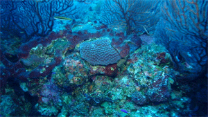
Back on our mooring, the shallow divers went in right below the boat. It was spectacular! Corals galore and bright sponges creating large mounds with lots of crevices for fish. One highlight was a large resident Nassau grouper. These have become quite rare and have been illegal to fish for decades, although illegal fishing continues. In fact, we saw two more small boats today fishing in the no-take zone around the island.
Reflecting on the last dive and the humpback whales seen out in the distance… it doesn’t get much better that this.
20 April 2011
Location: Bajo de Sico
Sweet!
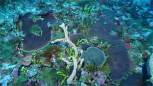
Today we begin work at Bajo de Sico, an isolate submerged bank off the west coast of Puerto Rico. Our expectations are high, as earlier work here suggested that there was lush coral cover throughout the bank. The divers go in, targeting a depth of 230 ft. There was coral everywhere, at some places reaching 70% bottom coverage. Almost all of it was various species of lettuce coral, dominated by Agaricia lamarki and Undaria humilis, but other species, including Montastraea cavernosa were also found. The broad area was of low relief and shallow slope, although small scale rugosity was quite high. This allowed some individual Agarica colonies to reach unprecedented size compared to what we have seen elsewhere. While the fauna and flora were lush they were only loosely attached, and this combination lead to the sample bag being rapidly filled and sent up 10 minutes early.
The ROV dive to 230 ft confirmed what the divers saw: high percent coral cover, with a diverse algal community, sponges and scattered black corals. One large colony of Agaricia lamarki was found to be almost 1 m in diameter. Unfortunately, we also noted a number of bleached and diseased colonies. The survey of corals was interrupted when a 24-in. yellowfin grouper swam over to check out the ROV. And yes, we did see a lionfish.
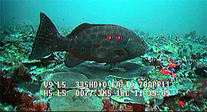
We ended our investigations for the day at the bank with a dive on the top, ranging from 75 down to 100 ft. The latter depth was associated with a plane on the south side suspected of being a site for a small spawning aggregation of Nassau grouper, although not at this time of the year. We did, however, see one grouper at the site, and several more were seen during the dive, as well as a couple of yellowfin groupers, which do spawn at this time of the year. One was fat with eggs.
21 April 2011
Location: Bajo de Sico
Hurry up, we’re heading to port!
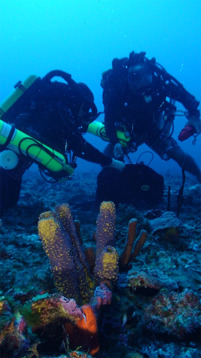
Nobody slept well last night – maybe the thought of having to re-adapt to “civilian” life. Tomorrow is Good Friday, so we have accelerated our schedule so the ship can pull into Isla Magueyes in time to get a few things before the stores close. Hopefully there are two rebeather heads waiting for us, the result of frantic emails and phone calls to various dive operations that support rebreather diving. We also need to restock our supply of trimix, get fuel for the boat, buy more food, restock batteries for cameras and rebreathers, and resupply the alcohol, buckets and jars used on the abundance of samples the divers collected. Our schedule today had the rebreather divers, the ROV and the shallow divers all in and out by noon.
The deep divers went down to 165 ft to discover a very live bottom, but this time one dominated by a diverse algal community. There were still the usual species of corals and sponges, but they were both fewer and smaller than were seen the day before at 230 ft. Because of the low inclination, the dive site was 1.8 km to the southwest of yesterday’s. The ROV confirmed these observations, getting down to 200 ft. Unfortunately, high currents prevented detailed observations and it was a struggle to keep the ROV on the bottom and in position.
We ended with another shallow dive on top of the bank in an area of high relief and equally high current. Divers reported seeing 4 Nassau groupers, making a total of 7 seen on the top – not too bad. Maybe protection is working.
23 April 2011
Location: Grappler Bank
Breaking new ground
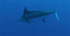
After a day in port, we left last night at 10:30 and headed east toward Grappler Bank, an isolated seamount some 10 miles south of the Puerto Rico platform. The top of the bank is 200 ft, and as far as we know, our rebreather team will be the first divers to see the bank, with the only other visit being a single dive conducted in the submersible SeaLink back in 1985. We choose a location on the northwest side of the bank and send the divers down to 210 ft. They find the bottom to consist of large pieces of rubble and occasional large sponges. There are some corals, but the colonies are small and very scattered. Nevertheless, they are able to send up a few samples with the lift bag. Although rubble dominated, the top of the bank is covered with a rich algal and sponge community. No big fish are seen on the bottom, but queen triggerfish seem to be common. This changes during the ascent, when the divers are treated to the sight of a blue marlin in midwater.
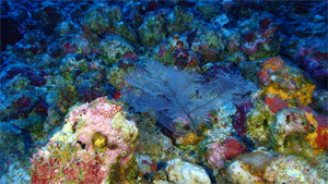
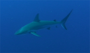
An ROV dive is made at the same site, but is able to go much further down the edge of the bank. But first the team deals with a power failure, which also seems to have knocked out the range detector on the tracker; but we still get an indication of direction. It was during this time that the large shark swam up to the ROV, turned and swam away. Unfortunately, we had not yet set the video camera to record. The top of the bank looks much like what the divers described, but at deeper depths there were areas with greater stability that hosted the formation of larger coral colonies. The deepest colony observed was a small Porities astreoides at 310 ft. Below this point the bottom forms a wall with small caves and ledges, still supporting a variety of algae and sponges, although densities became much lower. Our maximum depth was 377 ft. On the way up, at 328 ft, we saw our only lionfish of the dive.
A second ROV dive is made on one of the shallowest parts of the bank, between 197 and 216 ft at a site two miles to the southeast of the first site. Again the bottom consists of large pieces of rubble, but in this area there are more coral colonies and at least 6 different species are noted. At the end of the dive, by chance, we find a large aggregation of at least 30 queen triggerfish swimming together and extending up into the water column. These fish are known to make nests on the sand and lay benthic eggs, so the purpose of the aggregation remains unclear.
24 April 2011
Location: Grappler Bank
Looking toward a change in the weather
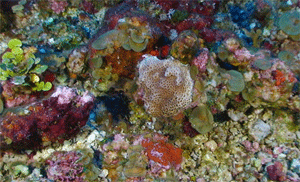
Once again the divers are off to explore the rubble environment on top of Grappler Bank. Descending to 213 ft, they are diving at the same site as yesterday’s second ROV dive, so they have a good idea of what to expect. This time there are more corals in the area, and Michael is busy collecting. Nick has put in a specific request for specimens of Montastraea cavernosa (great star coral) and was elated to find seven specimens coming up in the lift bag. But Michael also provided samples of other invertebrates and algae as well. The area is particularly rich in the latter, and samples will be processed when we return to the lab. Doug, our primary underwater cameraman, is also busy trying to capture the diversity of life in the rubble field. Among his finds on video is the pastel soft coral (Neospongodes portoricensis), a native but rare inhabitant of mesophotic depths, which as its scientific name implies, was first identified from Puerto Rican waters.
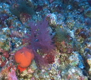
Following the divers, the ROV went in, specifically to look at the drop off on the south side of the bank. The scene was very reminiscent of that seen on the north side. We reached the bottom at 216 ft and no corals were seen until 260 ft when they became common, though still scattered, down to 310 ft. At this point the drop off was steep and getting steeper. Along the wall at 384 ft we still found black coral and an unknown sponge with needle like projections. On the way back up, at 246 ft, Rich used the ROV’s mechanical arm to grab a small sponge with the rubble base it was attached to, including other associated invertebrates and algae. Unfortunately, half way back to the surface the rubble base broke off, leaving only small piece of the bottom still attached.
We then left Grappler Bank and headed for Vieques Island to find safe shelter in preparation for the next day’s activities. The weather forecast is for increasing wind and waves for the next few days, which may cause us to change plans. Following our 3 hour run we arrived off the south coast of Vieques, to be greeted by torrential rain – a prelude of things to come. Here we paused to allow the shallow divers to inspect a spur and groove formation that dropped gradually to 90 ft, and more coral samples were collected for future genetic analyses. The night is spent anchored off the small town of Esperanza, where the sounds of salsa music can be heard from those celebrating the last of their Easter break.
25 April 2011
Location: El Seco, Vieques
About those sharks…
Wind and waves have increased, but not as much as predicted… yet. We head out toward El Seco, a southeast projection in the shelf break and home to the spawning aggregations of tiger and yellowfin groupers and dog and cubera snappers. But our objective is much deeper; we are trying to investigate the effect of exposure during the last sea level rise on the geomorphology that supports present day mesophotic reefs. Today we are visiting the east side, which is expected to consist of a gradual slope with rhodolith rubble supporting some corals and other invertebrates, as well as plenty of algae. The deep divers find more or less what was expected, except the corals were less abundant still. Yet the site was rich in fish, though most of it small. Milton got the sample of the day when he was able to capture a small juvenile parrotfish at 230 ft. Unidentified, it was one of many using a hole for shelter. On the larger side, Ivonne saw a 7 ft nurse shark and there were several visits by one or more Caribbean reef sharks. The last one occurred during their final safety stop at 15 ft.
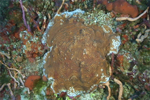
The ROV dive confirmed the observations made by the divers, but got a more extensive view of the site, including the terrace that extends out from 80-90 m before the slope falls away as a wall, a common feature all along the southern margin of the Puerto Rican-Virgin Island platform. One interesting find is that the rubble base consists of larger pieces in deeper water, which get progressively smaller until at about 53 m they start to drop out, with the substratum becoming more of a colonized hard bottom. With the mechanical arm, Francisco grabbed a rhodolith from 223 ft; surprisingly this contained a newly settled single coral polyp. From about 290 ft he collected a sponge with the vertical thruster.
We end the field activities with a shallow dive on the shelf south of the east end of Vieques where the platform dips down toward a sand-filled moat behind the shelf edge reef. We are greeted by a truly remarkable abundance and diversity of corals forming a bottom with overhangs and high rugosity, which in turn supported many fishes, including several Nassau groupers and a large hogfish.
With conditions getting a bit more bouncy, we seek shelter in a small bay at the eastern end of Vieques, a preserve that used to be a navy bombing range. We anchor and allow the crew to go snorkeling in the seagrass bed, amid an abundance of conch and unexploded ordinances. Nice anchor drop, Captain!
26 April 2011
Location: Southeast Vieques shelf break
“With three engines I can’t hold the ship into the wind”
With those words, Capt. Frank announces there will be no ROV operations at the Vieques site. And with the weather predicted to be much worse over the next two days we make the decision to head for St. Croix where there is the possibility of finding work sites in sheltered water. But first, we send the divers in on the shelf break not too far from where we spent the night.
The site was located at 165 ft, down a moderate inclination from the shelf edge at 145 – 150 ft. The substratum consisted of hard bottom with scattered colonies of Agaricia, some large, and M. cavernosa and other benthic invertebrates and algae. Looking down, they could see still larger colonies of Agaricia at greater depths. The ascent once again was accompanied by visitors, this time it was two remoras (shark suckers) looking for a place to attach themselves. Seems our divers were wearing too much gear to accommodate the fish, and they moved on. Then the fun began. The seas were up and the wind was blowing over 20 knots. Latching on to the safety line under these conditions is like a Nantucket sleigh ride, while trying to grab and climb a moving ladder requires timing, strength, and nerve.
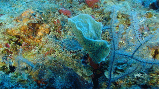
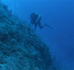
Nevertheless, after witnessing the above drama, the shallow divers decided get wet as well. More corals were sampled, and the recovery by the Spree was just as exciting.
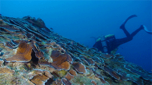
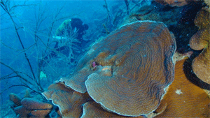
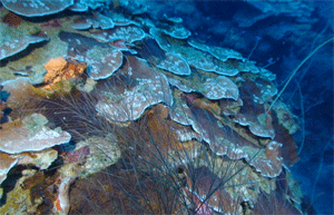
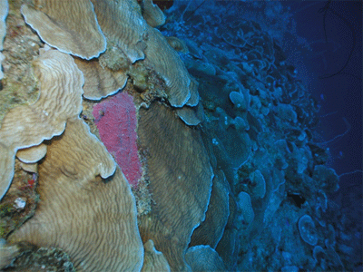
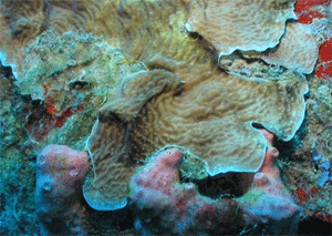
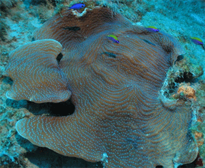
After four hours rocking and rolling on 6-10 ft seas we arrive off the west coast of St. Croix. The wind is still screaming and there is still no way to hold the ship to do ROV exploration of potential dive sites. However, our mooring site is only 200 ft from the shelf break, so we launch it off the stern and head west. The first thing we see, at the shelf break at 187 ft, is the largest coral head of we have ever seen in our 5 years of mesophotic studies, a massive expanse of Agaricia undata, the scroll coral. Below this depth the bottom drops precipitously. We search the wall down to 355 ft. Although sediment rains down from above, the wall still supports black corals and sponges, and in small caves we find baroque cave corals and sclerosponges. On the way back to the ship, on the top of the slope between 130 and 165 ft were outcrops supporting a variety of coral species. Back on board, we make plans to return the next day to quantitatively survey and sample the A. undata coral head.
April 27, 2011
Location: Sub Mooring, Frederickstad, St. Croix
The seas are angry this day, my friend
The wind is still blowing, but our morning plans call for us to stay on our mooring at Frederikstad. Our mission today is to have three divers return to the massive coral head of Agaricia undata to photodocument its structure, measure its dimensions and obtain small samples for genetic work to confirm that it, indeed, is one individual.cBottom time is precious, so to guide the divers directly to the spot, the ROV is launched ahead of time to locate the coral head. The divers then just follow the cable. The plan goes off without a hitch. In addition, the divers found a large cloud of plankton feeding fishes above the coral head, no doubt using the small crevices for shelter from predators. No such clouds were associated with nearby rock outcrops.
Meanwhile, Clark and Milton are on a mission of their own. They descend to 265 ft to look for and collect sclerosponges. These sponges are related to shallow sponges but only contain a thin film of tissue over a hard calcareous layered structure. Large specimens can reach hundreds of years in age, providing a time capsule of environmental conditions recorded in their skeleton. Back in the lab, the chemical composition of the skeleton will be analyzed and examined to determine past temperature trends that may reflect the effects of global warming at depths below the thermocline.
We next head around the northwest corner of the island to look at sites near Cane Bay. When we round the corner we encounter 6-10 ft waves. We battle our way over to Cane Bay, only to find there was no shelter to be found there. We beat a hasty retreat back to the west side of the island. After much searching, we find a potentially interesting site for tomorrow’s dive and decide to try deploying the ROV to do reconnaissance. Despite the high wind, Capt. Frank thinks he can hold the boat in position. However, he does not get a chance to demonstrate his skills. After prepping everything, the video fails to turn on. We spend the next hour and a half testing all the wires and connections, calling tech support, and poking around in the master control box – all to no avail. Then Francisco gets the idea to bypass our new color correction system and the video pops right back on. We are all in agreement on two points – Francisco is a whiz and who needs color correction. Unfortunately it is now too late to do the dive; the light is fading and the wind has increased, so we head back to our mooring for the night.
April 28, 2011
Location: West coast of St. Croix
Armageddon
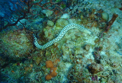
Well, yes, this what some of the crew are planning once we hit port this afternoon, but first it is the local name of a nearby dive site (where parts of the old pier were dumped) at the northwest corner of the island where our divers will check what is happening at mesophotic depths. At 165 ft they find a lush sponge and gorgonian habitat surrounded by a thin veneer of sand moving down slope over hard bottom. That moving sand is thought to prevent corals from surviving their early years, and indeed, few corals were observed. While the largest fish observed were red hinds, the highlight was sighting a sharptail eel swimming along the bottom.
High winds still prevent ROV operations, so in the afternoon we dropped the shallow divers to explore the “Swirling Reef of Death” (who comes up with dive site names?) to the south of Frederickstad.
And then……PORT CALL!!!
April 30, 2011
Location: Northwest coast of St. Croix
Capt.Frank: “I love the smell of chlorine in the morning”
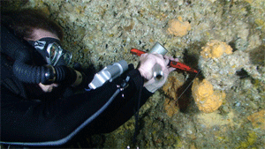
Smells like coral skeletons being prepared for morphological studies. Nick and his team of students are busy processing samples that have just come up from the divers. Michael and Ivonne have sent up coral samples from a site at 165 ft off Cane Bay, a slightly sheltered area on the still rough north coast. In the last two days conditions have improved just enough to send in the divers. ROV operations are still not possible without mooring; fortunately, we were able to do an ROV dive at this site last year. Meanwhile, Clark, Doug and Milton went searching for more sclerosponges, and the weight of their sample bag indicated success. Sclerosponges are typically found in small caves and crevices, and we know from past experience that the vertical wall here, which starts at 180 ft, has plenty of these. On this dive, however, they find a huge cave, with the opening extending from 260-270 ft. The cave is rich in sclerosponges, which are attached to the ceiling of the cave. Clark attacks the first specimen with his hammer and chisel and all are horrified as he fails to grab it as it breaks free and starts to plummet to the abyss. Fortunately, it only falls to the cave floor and is recovered. Further along the ledge Clark finds the best specimen yet, but despite numerous attempts by Clark and Doug, they cannot break it free. With the clock ticking, they abandon the site and head back up. Back on board, Nick discovers a wealth of other organisms attached to the base of the sponges: baroque cave corals, small bivalves, tube-dwelling polychaete worms and even a very small eel.
We finish off the morning with a shallow dive, and land on a spot near the upper break with a well-developed spur and groove system. It has a diverse and abundant coral community coupled with a small hawksbill turtle and the biggest schoolmaster snapper any of us have ever seen. During lunch, Capt. Frank used the depth sounder to record the profile of the slope off Cane Bay and several nearby sites.
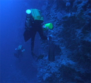
After lunch we explore an area off the southwest tip of the island. The depth sounder indicates a more gradual slope than the other sites here and a hard bottom. With ROV operations out of the question, we send two divers down to take a look, at least at the shallower end. And the top of this looks great: plenty of coral, giant white margates, spawning (?) smooth trunkfishes. Unfortunately, this excitement does not extend deep. The coral habitat runs out at 90 ft and the rest consists of sand covered hardbottom, albeit with lots of sponges and gorgonians, as far down as the eye could see. We return to our mooring off Frederickstad to discuss our options for the coming day.
May 1, 2011
Location: Northwest coast of St. Croix
The ROV strikes back, but so do the gorgonians
We head out once again for the area around Cane Bay, to a point to the west near a dive site called North Star. The weather has improved enough for us get the ship far enough in to operate, as the shelf break is close to shore. The divers are going to check if the area of high coral cover seen at 150+ ft at Cane Bay extends further to the west. They find the site to be a bit steeper, but the corals were even more abundant, healthier and with larger colonies. Magnificent coral heads tower 30 ft up the slope. Diversity is high and black corals abound. Accompanying the corals were lots of planktonic feeding fishes, a few yellowtail snappers, but as Ivonne said “only one reef shark”.
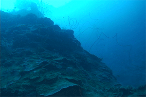
Profiles of the slope using the ship’s fathometer show the slope to have an interesting geomorphology, with perhaps a ledge at 185 ft that may form an outer reef drop further west. Just as we decide to explore this with the ROV the winds starts to increase. Yet, Capt. Frank proves his mettle (again) holding the ship steady as the ROV goes down to 270 ft. As seen in the fathometer profile, there was a slightly less steep section at 180 ft with a higher sand cover, but by 210 ft the profile turned noticeably steeper, eventually becoming a vertical wall. The wall supported sponges, gorgonians and black corals. Coming up, the first corals were seen at 230 ft and became progressively more common and diverse at shallower depths. Francisco was able to use the mechanical arm to collect a sample of Agaricia grahamae (dimple sheet coral), a species that is both uncommon and difficult to identify except at very close range.
Shallow divers went in immediately after, forcing a delay in lunch, but it was worth it (to those on the dive). Another great dive on a beautiful coral reef that extended to below 100 ft, highlighted by the sighting of a moderate sized cubera snapper (31 inches) and a beautiful example of a spiny flower coral.
Wind and wave conditions continuing to improve, although we now have rain, so we head off in the afternoon for a second ROV dive, this time on the western wall of Salt River Canyon. The canyon is famous in diving circles as the former location of Hydrolab, the first manned underwater habitat. Our dive is located more toward the mouth of the canyon, and Capt. Frank is once more put to the test, this time trying to avoid other nearby dive boats. As the name implies, the slope is near vertical, but the high amount of sediment raining from above prevents much life from occupying the wall. This is disappointing, as past scientific studies further inside the canyon led us to believe we would encounter a more vibrant community. No corals were observed below 125 ft, and only four colonies were seen in total. However, they were each of a different species of agariciids. The dive ended early when Rich decided to get a close up of the last of these by driving the ROV into the gorgonians that were guarding the coral. The result was gorgonian in the forward thrusters, and the ROV had to be pulled out (gently) by the cable, breaking the ROV’s trim tab in the process.
We end the day moving into Christiansted harbor for the evening. We cannot go to shore, but the change of scenery is appreciated.
May 2, 2011
Location: Northwest coast of St. Croix
Winds 20-25 kts, waves 5-8 ft, flash flood warnings
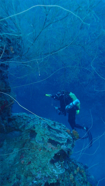
This is the forecast that greets us for our planned return to Salt River. Undaunted, we steam out to see for ourselves.Unfortunately , the weather forecasters are right. We meet briefly to form a new plan, and we are off again to the Cane Bay area to finish our collecting goals. The deep divers also enter near a break in the reef where a large sand channel feeds in from shore. This was the feature we had seen on the fathometer the day before. What they find is a stunning seascape of deep and steep coral-covered forereef covered sliced through by a small canyon. The walls along the canyon are steep and similar to the wall seen further down. Clark finds a good-sized sclerosponge in a small cave along the wall at 190 ft, while the others are collecting more specimens of deep corals further up at 165 ft. The pattern of fish bites on corals, seen previously on a few colonies at Grappler Bank, were much more abundant here. Yet, the occurrence is patchy, giving some of the colonies a diseased-like appearance while others nearby were unaffected.
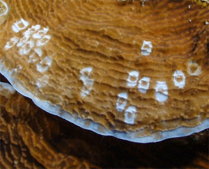
The weather is taking its toll, and we are all feeling the strain from frustration on top of the past weeks of steady work. Nevertheless, the shallow divers are eager to go in again for collections and to inspect the large sand channel observed before. The top of the reef plummets sharply down forming a strong spur and groove structure. Some of the spurs are large structures, which from below give us the first impression in shallow water of what the deep divers have been seeing, except that in this case much of the Agaricia is dead (relative to below) and covered with the brown algal Lobophora. Some of these are crowned with a halo of plankton feeding fishes; it is an inspiring site. As for the sand channel, our lead diver turns right, and before anyone can catch him we are committed to going the wrong direction.
Once again, ROV operations are not possible, so we beat an early retreat back to Christiansted harbor, where processing and report writing await us.
May 3, 2011
Location: Northwest coast of St. Croix
“Preserving the present for the future….in alcohol”
Today is our last working day on the cruise, and that thought has animated everyone. Even the weather is cooperating. We return to the area of Cane Bay for one more deep collecting trip. Nick has ordered one last targeted effort to collect black corals for identification and great star corals for genetic studies. The divers deliver, bringing back both from 165 ft, and Nick and his team catalog and preserve the specimens for future lab work. At the end of their decompression, the divers are recovered and climb up the ladders, hauling their 90-lb loads one last time up to the dive deck of the Spree.
With the winds down at bit, we make the decision to do an ROV dive, so back to Salt River we head to check out the east side of the canyon. Francisco encounters the canyon wall at 265 ft and starts to move up. The lower region is much like the west side, but perhaps with a bit more sponge and black coral. This all changes as the ROV ascends to 165 ft. The wall breaks to a steep slope, and outcrops support an abundance of corals. One of the large coral heads is composed of the sunray lettuce coral, Helioceris cucullata, a species that to date has only been found occasionally. Here it was in abundance. The abundance of corals is followed up to 110 ft until, once again, the thrusters suck up enough gorgonian strands to immobilize the ROV, requiring it to be pulled up by the cable.
With that our field work is done. We head for calmer waters where we can concentrate on writing up the day’s reports before we begin the 13-hr trip home.
May 4, 2011
Location: The dock at Magueyes Island, La Parguera
Next year we are going to……
We arrive at 7 am and quickly unload all the gear we brought and specimens we collected. Within 2 hours everything is off the ship and into the respective laboratories of the scientific staff. Now the real work begins. This includes creating slope profiles from bathymetry data, the genetic and morphological studies, the collation of fish counts, the processing of the phototransects, the statistical analyses of all these data and, finally, making sense of all of it.
During our run back to Puerto Rico there was lively discussion on where to go next. Now, if only we can get some more grant funding…
