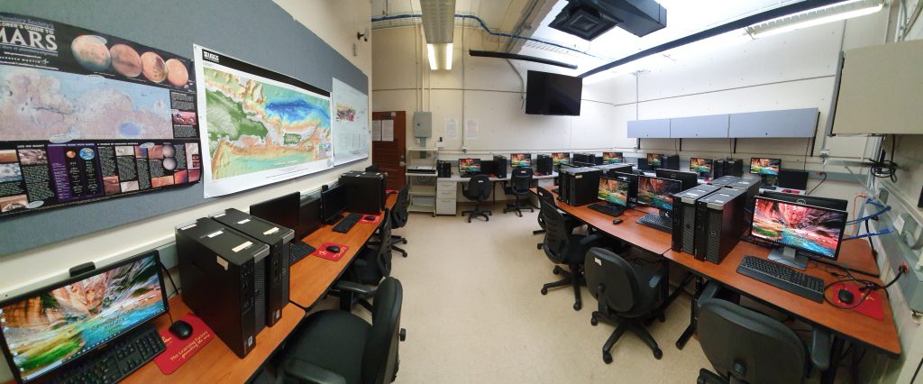
GERS Lab is one of the most advanced laboratories for environmental remote sensing and Geographic Information Systems in the Caribbean region. We conduct image processing and analyses of several sensors, including SeaWiFS, AVHRR, MODIS, OLI, SAR, IKONOS, Hyperion, AVIRIS, Sentinel and VIIRS, among others. Our research and teaching facilities include personal computers with ENVI and ArcGIS software, a server, scanners, a plotter, and color printers.
Image Processing Facilities
Bio Optical Rosette
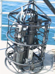
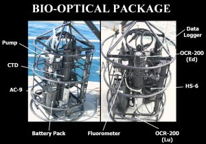
We have assembled a rosette with several oceanographic and bio-optical instruments. This rosette is used to measure the bio-optical properties down to 200 meters. A CTD SBE-19 with pump (from Seabird) measures depth, temperature, and salinity. A WetStar fluorometer (from Wet Labs) measures chlorophyll fluorescence. The spectral transmittance and spectral absorption are measured over nine wavelengths with the AC-9+meter attached to a pump (from Wet Labs). The backscattering coefficient at six wavelengths is measured with the HydroScat-6 sensor (from Hobi Labs). Upwelling radiance and downwelling irradiance are obtained using the OCR-507 submersible radiometers (from Satlantic). All data, except the backscattering, are stored in a data logger (from Wet Labs) for downloading to the computer after deployment.
Portable Spectroradiometer
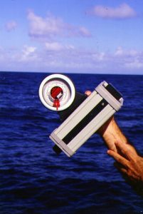
Reflectance measurements are obtained based on the object-leaving radiance and downwelling irradiance at multiple wavelengths using the GER 1500 Spectroradiometer from Spectra Vista Corporation.
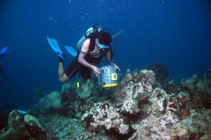
We have also the water-proof cage of the GER 1500 spectroradiometer for underwater reflectance measurements. This case allows us to make measurements of different bottom types, like coral reefs as shown in the image.
Global Positioning Systems
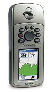
GPSMAP 76CS – This Garmin HandHeld GPS System has the latest color-display technology, giving this unit one of the brightest, sunlight-readable displays available. Its state-of-the-art receivers and powerful microprocessors give to this GPS a quick and steady fix. The GPSMAP 76CS also has the following features: WAAS-enabled, 12 parallel channel GPS receiver / Built-in quad-helix antenna with remote antenna capability / Electronic compass displays accurate heading while standing still / Barometric sensor with automatic pressure trend recording / Elevation computer provides current elevation, ascent/descent rate, minimum/maximum elevation, total ascent and descent, average and maximum ascent and descent rate / 115-MB internal memory for loading MapSource detail, including marine cartography / USB connectivity for quick chart and map downloads / 256-color transreflective TFT display (1.5″ W x 2.2″ H; 2.6″ diagonally); color operating system / Weighs 7.6 ounces (with batteries) / Up to 20 hours battery life (uses two AA alkaline batteries) / Permanent user-data storage; no memory battery required.
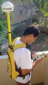
Pathfinder Pro XRS – This is an easy-to-use Trimble GPS receiver designed for GIS data collection and data maintenance. It provides real-time submeter accuracy GPS with built-in SBAS, OmniSTAR, and beacon capabilities. With built-in real-time options we have less equipment to worry about, and can maximize the productivity in the field. Together with a hand-held computer and software, the GPS Pathfinder Pro XRS receiver provides a two-way data flow between the field and GIS, facilitating the data collection and data maintenance processes. Because the GPS Pathfinder Pro XRS integrates real-time DGPS, it is easy to navigate directly to an asset for verification and update. By taking advantage of these real-time features, you remove the need for postprocessing GPS data—further closing the gap between field work and the GIS. The high resolution of this GPS receiver is helping us to better validate the airborne and spaceborne images, especially those with high spatial resolution, like IKONOS.
Laboratory Equipment
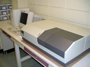
Lambda 18 UV/VIS Spectrometer – This instrument from Perkin Elmer is used to measure the absorption coefficient of particles, detritus, phytoplankton, and colored dissolved organic matter. We also have an Integrating Sphere that can be attached to it and provides more accurate measurements of absorption.
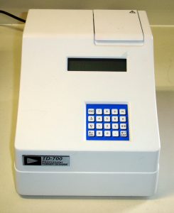
TD 700 fluorometer – This is a compact, versatile, sensitive, and low-cost benchtop fluorometer made by Turner Designs that features a unique multi-assay filter cylinder, wide wavelength range, menu-driven software, RS-232 serial interface, and multi-point calibration. A variety of fluorophores can be easily measured using application-specific optical kits available from the company. We use this instrument to measure the concentration of phytoplankton Chlorophyll-a, an important water-quality parameter measured with remote sensors.
Satellite Receiving Station
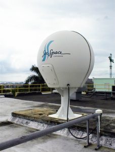
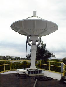
We have closed collaboration with the Space Information Laboratory (SIL) of the NASA-created UPRM Tropical Center for Earth and Space Studies. SIL aims to provide data from several orbiting satellites to the scientific community. Its facilities currently house a TeraScan HRPT reception system from SeaSpace which schedules, acquires and processes data from several sensors.
The antenna system consists of a 1.2 m diameter parabolic antenna enclosed in a dome, and a 4-foot high steel pedestal. It is located on the Research and Development Center Building, one of the highest point of the UPRM campus. Its location makes possible the acquisition of data at very low angles, covering from the Mid-Atlantic Ocean to the Gulf of Mexico and from Brazil to Northern United States.
Data collected with the SIL system is actually used by GERS LAB for teaching and research purposes. AVHRR data provide information of the Sea Surface Temperature, Vegetation Index, and hurricanes track in the region. SeaWiFS has been used to study the phytoplankton dynamics of the Caribbean Sea.
SIL also has a X-Band antenna with capability to receive images of Synthetic Aperture Radar (SAR) from RADARSAT, Enhanced Thematic Mapper Plus (ETM+) from LANDSAT-7, and Moderate Resolution Imaging Spectroradiometer (MODIS) from Aqua and Terra.
