Author: James Goodman, Ph.D.
Institution: University of Puerto Rico Mayaguez
Year: 2007 – 2008
The primary objective of the project is to provide a more comprehensive assessment and mapping of the shallow coastal resources for selected areas along the coast of Puerto Rico. Specifically, we will extract information on habitat composition and water properties using the enhanced capabilities of hyperspectral remote sensing. Output from this research will exceed the existing map resources for this area by providing managers with a spatially explicit indication of the distribution of existing benthic coastal resources.

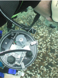
The major accomplishment for this project is the collection of high-resolution hyperspectral imagery and extensive field data over the nearshore reefs and coastal ecosystems in southwest Puerto Rico. The hyperspectral imagery was collected in November and December 2007 by the Galileo Group Inc. using the AISA Eagle sensor system, as contracted with funding from CCRI and Gordon-CenSSIS. The total area included in the image collection was 1740 km2 at 4 m spatial resolution, with repeat coverage of four science areas, three aquatic and one terrestrial, at 1, 2, 4 and 8 m spatial resolutions. The collection of field data spanned the timeframe from July 2007 through December 2008. Field data included measurements of spectral calibration targets, habitat reflectance characteristics (i.e., spectral library) and >1000 photos (with GPS locations) of benthic habitat composition. This field data is being used to assist with image classification tasks and in the accuracy assessment of derived mapping products.
The original objective of the research project was to develop habitat maps of select locations in southwest Puerto Rico using the advanced capabilities of hyperspectral remote sensing. By leveraging resources available through Gordon-CenSSIS, the overall project was expanded to include a larger study area, more extensive field data collection, and improved image analysis capabilities.
References & more
