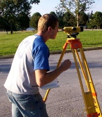
The Surveying Laboratory has an area of 1,720 square feet. This space stores the equipment and instruments used for the courses and investigations offered in the Civil Engineering and Surveying and Topography programs. It counts with instruments such as transit, level, total station, digital level, distance meter, electronic data collectors, global positioning system receptors, stereoscope, tape, milestone, and tripods. It also has the necessary equipment to do jobs of horizontal and vertical control of first order. Furthermore, it stores a electronic map library of the topographic quadranglesgeo-referenced from the Geological Service of the United States or USGS (for its acronym in English) in scale 1:30, 000 and 1:20,000. This laboratory features the oldest collection of aerial photographs taken of Puerto Rico in 1930 named PORTO RICO 1930, in a digital format, which are available online. In addition, it has available the digital format aerial photographs taken by the National Oceanic and Atmospheric Administration or NOAA (for its acronym in English).
Computers today are an indispensable tool in all fields of knowledge, and Surveying is not an exception. An indispensable component of surveying students is a computer with programs to do calculate and draw plans. In the Surveying and Topography Laboratory, programs such as AutoCAD, MrCAD, SurvCAD, SurveyPRo, and others are available. When it comes to Geographic Information System or GIS it has programming of ArcGIS of ESRI and its extensions 3D Analysis, Spatial Analysis, GeoStadistics, and Survey Analysis. Regarding Global Positioning System or GPS, we feature receivers of a single frequency and dual frequency differential mark or Real Time Kinematic.


